
Best Trails in Grey Highlands
Top Trails
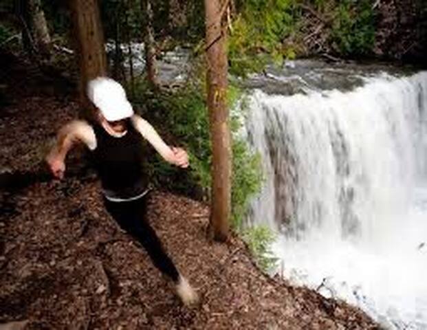
This hike combines the blueblazed Standing Rock and Singhampton Side Trails with the white-blazed main Bruce Trail. In this section, each blue-blazed side trail leads you back to the main Trail, and each junction is signed. You should not get lost! From your car, the white blazes will lead you straight north to a lookout area.
Before you is the forested beauty of the Pretty River Valley; its mature deciduous forest is especially beautiful in the fall. The edge of the Niagara Escarpment is cut here with narrow, deep crevices, and you can clamber through the tight fissures.
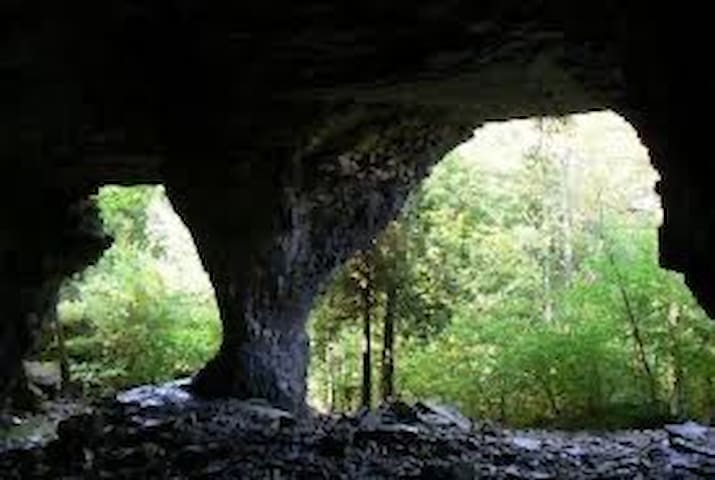
These crevice caves, open to the sky, were created when huge blocks broke away from the cliff face. Mosses and liverworts form a moist green carpet on the crevice walls, and 27 species of fern have been recorded within this small area. The blue-blazed Standing Rock Side Trail heads down the Escarpment to a rock pillar, isolated 80 m north of the edge. It is a testament to the powers of erosion over eons.
Move carefully among the rock debris as you follow the blazes. The Singhampton Side Trail at its eastern end will connect you back to the main Trail, which then swings to the west to return you to your car.
With file information from the Bruce Trail, for more information on this and other Bruce trails please purchase the Bruce Trail map and trail guidebook. The Bruce Trail is the oldest and longest marked hiking trail in Canada. It is 840 km long, with over 440 km of side trails. Every year more than 400,000 visits are made to the Trail as people walk, snowshoe, watch wildlife, take photographs and admire the glorious scenery of the Escarpment.
6 locals recommend
Singhampton Caves Trailhead
109 Eagle CrescentThis hike combines the blueblazed Standing Rock and Singhampton Side Trails with the white-blazed main Bruce Trail. In this section, each blue-blazed side trail leads you back to the main Trail, and each junction is signed. You should not get lost! From your car, the white blazes will lead you straight north to a lookout area.
Before you is the forested beauty of the Pretty River Valley; its mature deciduous forest is especially beautiful in the fall. The edge of the Niagara Escarpment is cut here with narrow, deep crevices, and you can clamber through the tight fissures.
These crevice caves, open to the sky, were created when huge blocks broke away from the cliff face. Mosses and liverworts form a moist green carpet on the crevice walls, and 27 species of fern have been recorded within this small area. The blue-blazed Standing Rock Side Trail heads down the Escarpment to a rock pillar, isolated 80 m north of the edge. It is a testament to the powers of erosion over eons.
Move carefully among the rock debris as you follow the blazes. The Singhampton Side Trail at its eastern end will connect you back to the main Trail, which then swings to the west to return you to your car.
With file information from the Bruce Trail, for more information on this and other Bruce trails please purchase the Bruce Trail map and trail guidebook. The Bruce Trail is the oldest and longest marked hiking trail in Canada. It is 840 km long, with over 440 km of side trails. Every year more than 400,000 visits are made to the Trail as people walk, snowshoe, watch wildlife, take photographs and admire the glorious scenery of the Escarpment.
Check out this 3.9-km loop trail near Grey Highlands, Ontario. Generally considered an easy route, it takes an average of 1 h 7 min to complete. This is a popular trail for birding, hiking, and snowshoeing, but you can still enjoy some solitude during quieter times of day. The trail is open year-round and is beautiful to visit anytime. Dogs are welcome, but must be on a leash.
14 locals recommend
Nottawasaga Lookout Provincial Nature Reserve
9749 County Road 91Check out this 3.9-km loop trail near Grey Highlands, Ontario. Generally considered an easy route, it takes an average of 1 h 7 min to complete. This is a popular trail for birding, hiking, and snowshoeing, but you can still enjoy some solitude during quieter times of day. The trail is open year-round and is beautiful to visit anytime. Dogs are welcome, but must be on a leash.
Klondyke Trail Groomers
614406 Hamilton LnHogg's Falls Loop
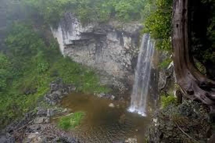
Explore this 5.3-km loop trail near Grey Highlands, Ontario. Generally considered a moderately challenging route, it takes an average of 1 h 33 min to complete. This is a popular trail for birding, hiking, and snowshoeing, but you can still enjoy some solitude during quieter times of day. The best times to visit this trail are March through October. Dogs are welcome, but must be on a leash.
60 locals recommend
Hoggs Falls
Explore this 5.3-km loop trail near Grey Highlands, Ontario. Generally considered a moderately challenging route, it takes an average of 1 h 33 min to complete. This is a popular trail for birding, hiking, and snowshoeing, but you can still enjoy some solitude during quieter times of day. The best times to visit this trail are March through October. Dogs are welcome, but must be on a leash.
Duncan Caves Trail
Duncan
Beaver Valley Short Loop
Enjoy this 23.3-km loop trail near Grey Highlands, Ontario. Generally considered an easy route, it takes an average of 6 h 45 min to complete. This trail is great for backpacking, hiking, and off-road driving, and it's unlikely you'll encounter many other people while exploring.
Grey County Road 13
Grey Road 13Enjoy this 23.3-km loop trail near Grey Highlands, Ontario. Generally considered an easy route, it takes an average of 6 h 45 min to complete. This trail is great for backpacking, hiking, and off-road driving, and it's unlikely you'll encounter many other people while exploring.
Sydenham
Explore this 4.5-km loop trail near Meaford, Ontario. Generally considered an easy route, it takes an average of 1 h 9 min to complete. This trail is great for birding, hiking, and snowshoeing.
N4K 5P7
Explore this 4.5-km loop trail near Meaford, Ontario. Generally considered an easy route, it takes an average of 1 h 9 min to complete. This trail is great for birding, hiking, and snowshoeing.
Silent Valley Trail
Tucked between the gentle slopes of a long-vanished glacial landscape and the soaring cliffs of the Niagara Escarpment is an oasis of peace and tranquillity - Silent Valley.
The peaceful forests, flower-rich meadows and sparkling wetlands belie its turbulent past, a past that extends 12,000 years to a time of glacial scouring and upheaval, through to the settling by pioneers in the 1800s, and later the industrial harvesting of trees for commercial use. Evidence of this turbulence is found in the hills of glacial debris, scouring of the Escarpment rock, the ruins of a sturdy homestead with its apple trees and tangled gardens, and the scars of indiscriminate logging.
Now - with the acquisition of this diverse 200 acres by the BTC - the land is once again silent. The forest, home to the endangered Butternut, is filling in, blurring the scars of the past. The bright meadow that was cleared for farming and logging is now a place of tranquillity. And ancient cedars and rare ferns have a safe haven on the Escarpment cliff face.
Concession Road 2 South
Concession Road 2 SouthPetun Conservation Area Trail
This is a relatively short hike, it took us just under two hours to complete.
You'll park the car on the north side of the road. Cross over to the south side, then head east along the Petun Side Trail. You'll soon head down a driveway and over a creek. Follow the road allowance through the trees.
After about half an hour you will come upon the old fields filled with flowers (at least they were in July).
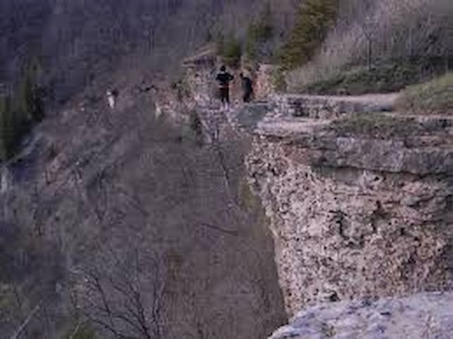
About 15 minutes later you will begin a long, wonderful climb up the escarpment edge. There are all sorts of trees around, and large blocks of limestone to climb through.
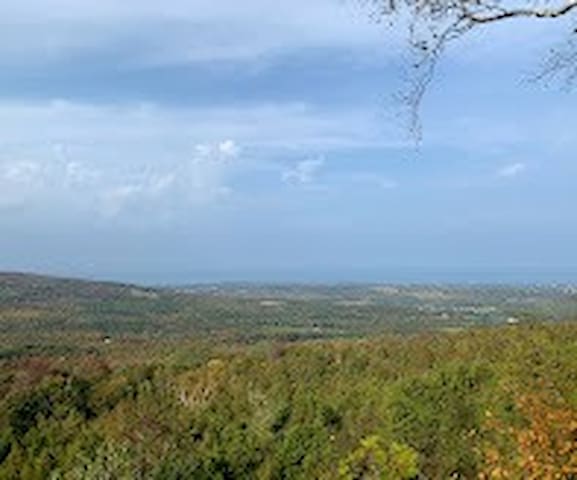
Just under an hour after leaving the car you'll arrive at the top of the escarpment, with views out over the valley. This is the south end of the Petun Side Trail. It joins the main Bruce Trail at km 46.4.
We turned right (west) at this point, but you can extend the hike by heading south along the main trail, then heading west and north along the Osler Side Trail.
The hike west along the main trail between km 46.4 and 48.1 is pretty flat, around another field, with good tree coverage. Toward the end there are all sorts of interesting rocks covering the ground.
At km 48.1 you will come to a quiet sideroad (2nd Line). Turn right (north), for a 20 minute downhill walk towards the
Petun Conservation Area
This is a relatively short hike, it took us just under two hours to complete.
You'll park the car on the north side of the road. Cross over to the south side, then head east along the Petun Side Trail. You'll soon head down a driveway and over a creek. Follow the road allowance through the trees.
After about half an hour you will come upon the old fields filled with flowers (at least they were in July).
About 15 minutes later you will begin a long, wonderful climb up the escarpment edge. There are all sorts of trees around, and large blocks of limestone to climb through.
Just under an hour after leaving the car you'll arrive at the top of the escarpment, with views out over the valley. This is the south end of the Petun Side Trail. It joins the main Bruce Trail at km 46.4.
We turned right (west) at this point, but you can extend the hike by heading south along the main trail, then heading west and north along the Osler Side Trail.
The hike west along the main trail between km 46.4 and 48.1 is pretty flat, around another field, with good tree coverage. Toward the end there are all sorts of interesting rocks covering the ground.
At km 48.1 you will come to a quiet sideroad (2nd Line). Turn right (north), for a 20 minute downhill walk towards the